Plate Analyzer
Automatically analyze the license plates around you.
TL;DR
You send a folder of images of vehicles and I’ll send back structured data about the images with legible license plates so you can quickly answer questions about them.
MVP Product offering
Send me a dropbox or google folder of the original JPEG GoPro/iPhone/Android photos you want analyzed and I’ll take care of the rest.

What you’ll get
Summary: A summary report: total images with identifiable licenses, identifiable license plates encountered (there can be more than 1 in an image), average violations per vehicle w/violations.

Spreadsheet: A spreadsheet of every vehicle encountered in your trip. It’ll include a treasure trove of publicly accessible data in a structured, easily queryable format:
- License (via PlateRecognizer)
- State
- Vehicle make/model/color
- Average Value of the vehicle (via Edmunds)
- Violations (from How’s My Driving NYC)
- Latitude & Longitude of observation
- Timestamp of photo (observation time)
- Address (via NYC Geoclient, the city’s closest official address)
- A public URL for the image (on AWS S3)
- Nearest cross streets
- NYPD precinct and sector
- Community Board


Map: A custom google map with everything mapped & color coded that you can easily share. (Color coding could be for vehicle type, number of violations, or other categories)


Images on S3: Each image that has a recognized plate will be uploaded to S3. You’ll have a public URL for each image (in the spreadsheet) so you can easily reference the images and put them in articles/tweets without having to store them locally.
Quickly answer questions like…
- How many violations do all the illegally parked / placard abuse vehicles have? (Which is what Streetsblog has done, manually.)
- How many vehicles did I encounter (parked or driving) on my bike ride?
- How dangerous was my bike ride, based on violations?
- How many out of state licenses are there?
- What percent of vehicles have violations?
- Which vehicles were most dangerous?
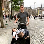
Gathering photos
There are a few simple ways to obtain images that can be analyzed.
- Use your iPhone or Android and just walk around and snap pics of whatever you want analyzed. OR
- Use a GoPro 6/7/8 (chest or helmet mount), set to time lapse photo and take a photo every 0.5 sec.
Put all these photos in a Dropbox or Google Drive folder that you can share via email.

Interested?
Email me at reportedapp@gmail.com